

SMALLSATS
Image data systems for small satellites
De-risk with experienced partner and proven solutions
Generate quality products that meet market expectations and needs of AI
Scale as you grow from single satellites to constellations
Deploy on premises (Keystone), or as a SaaS (Cloudstone)
Extend to new applications with onboard processing module (Bluestone).
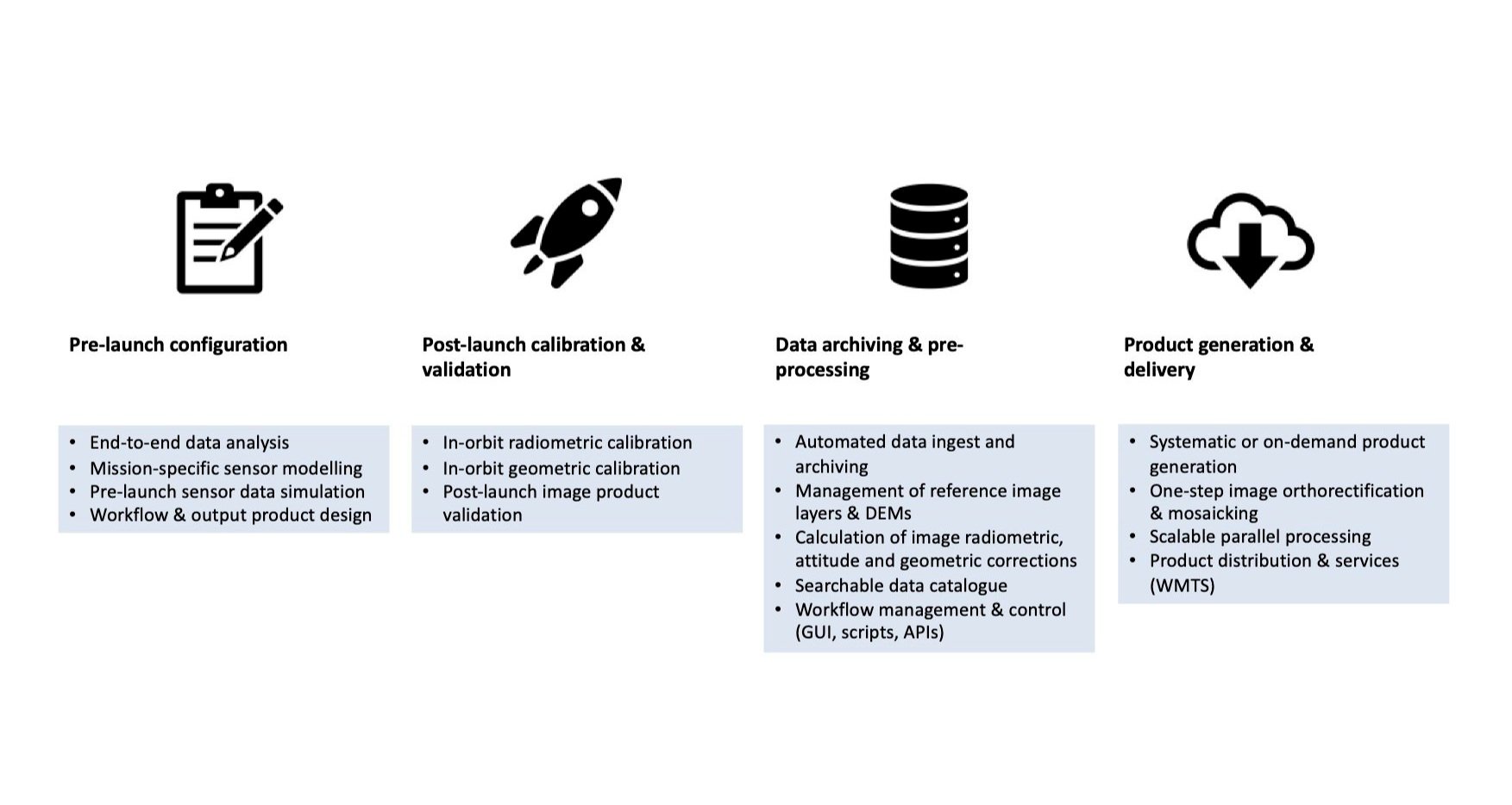
PROVEN SOLUTIONS
Best possible product quality
We have delivered EO smallsat data systems for nearly 20 years. To drive our customers’ success we empower them to generate products comparable to much more costly missions.
Our approach is to de-risk by identifying items in the end-to-end system that impact data quality. Mission-specific sensor models support high product accuracy for AI and other analytics, with parameters updated after launch through calibration & validation activities.
The processing concept records all correction parameters without applying them. When a product is ordered all corrections are applied in a single step for optimum speed and quality.

RADIOMETRIC CORRECTIONS
Radiometic correction parameters are systematically calculated and recorded. They can be applied to image data during product generation or on-the-fly data visualisation. Example corrections include:
Dark signal correction
Blind pixel removal
Relative response correction
Column & row destriping
Light falloff correction
Atmospheric correction.

GEOMETRIC CORRECTIONS
Corrections to the image geometry are calculated systematically and recorded. Image geometrical correction involves:
Initial image geometry from sensor model, and satellite orbit & attitude data
Attitude data update to enhance band registration
Automatic measurement of ground control points (GCPs) against reference data
Refinement of image geometry by least-squares adjustment of model parameters.
Product generation is a one-step process that applies all data corrections together with the target product definition. Orthorectification of image data to a map projection uses the refined image geometrical model and a DEM. Ortho-ready images are an alternative product.

For more information: